The NANO Team developed A Guide to Thrive as a response to our exclusive invitation to the 2021 Venice Biennale TIME SPACE EXISTENCE exhibition. Our award-winning installation, SUBMERGED EXPERIENCE, highlighted the similarities between New Orleans and Venice, and from there, A Guide to Thrive quickly catapulted into various national presentations and conversations surrounding mitigation strategies and design solutions for coastal cities around the world.
There is an ever more clear and urgent call to action, as our future is tied to one that moves beyond the sustainable to the regenerative. Sustaining being the attempt to survive, but as a species we are driven to move past mere surviving to thriving.
What is our vision for the future?
We look to the Latin word, Arx, as inspiration. An Arx is a stronghold, fortress, central community location, a refuge.
Our multi-scalar presentation and solution dissects issues within our current infrastructure, economic, environment, government, and society’s systems.
Both practical and multi-purpose, the Arx would allow the New Orleans community to not only adapt in a time of intensifying storms, but also to thrive.
The implementation of the Arx is the first step in a long-term strategy to deal with the impacts of climate change. If we can approach climate solutions one step at a time, starting with mitigation, it allows us to think about plausible and practical solutions that engage with and challenge the way we think about current infrastructural and economic systems. In order to optimize opportunity, each Arx must meet four crucial design components in order to be successful during times of stability and instability.
Project Team
- Terri Dreyer
- Ian Dreyer
- Kristine Kobila
- Samantha Johnson
- Sam LeBlanc
- Kelsey Chappuis
- Ana Chu
- Maria Ory
- Jeremy Baudy
- Evie Bentch
- Hannah Hubbell
- Phoebe Dunn
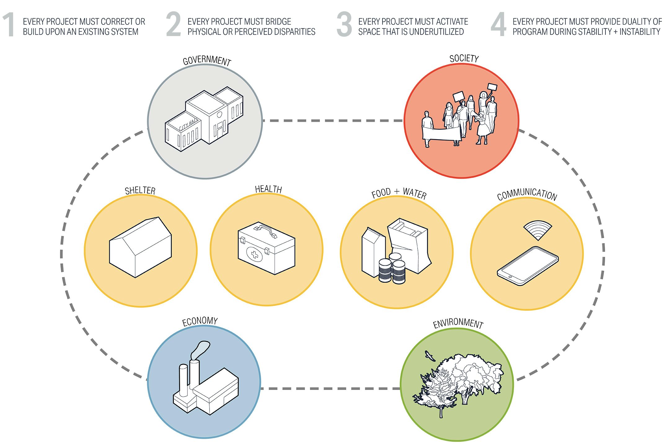
Optimize Opportunity | Program Criteria
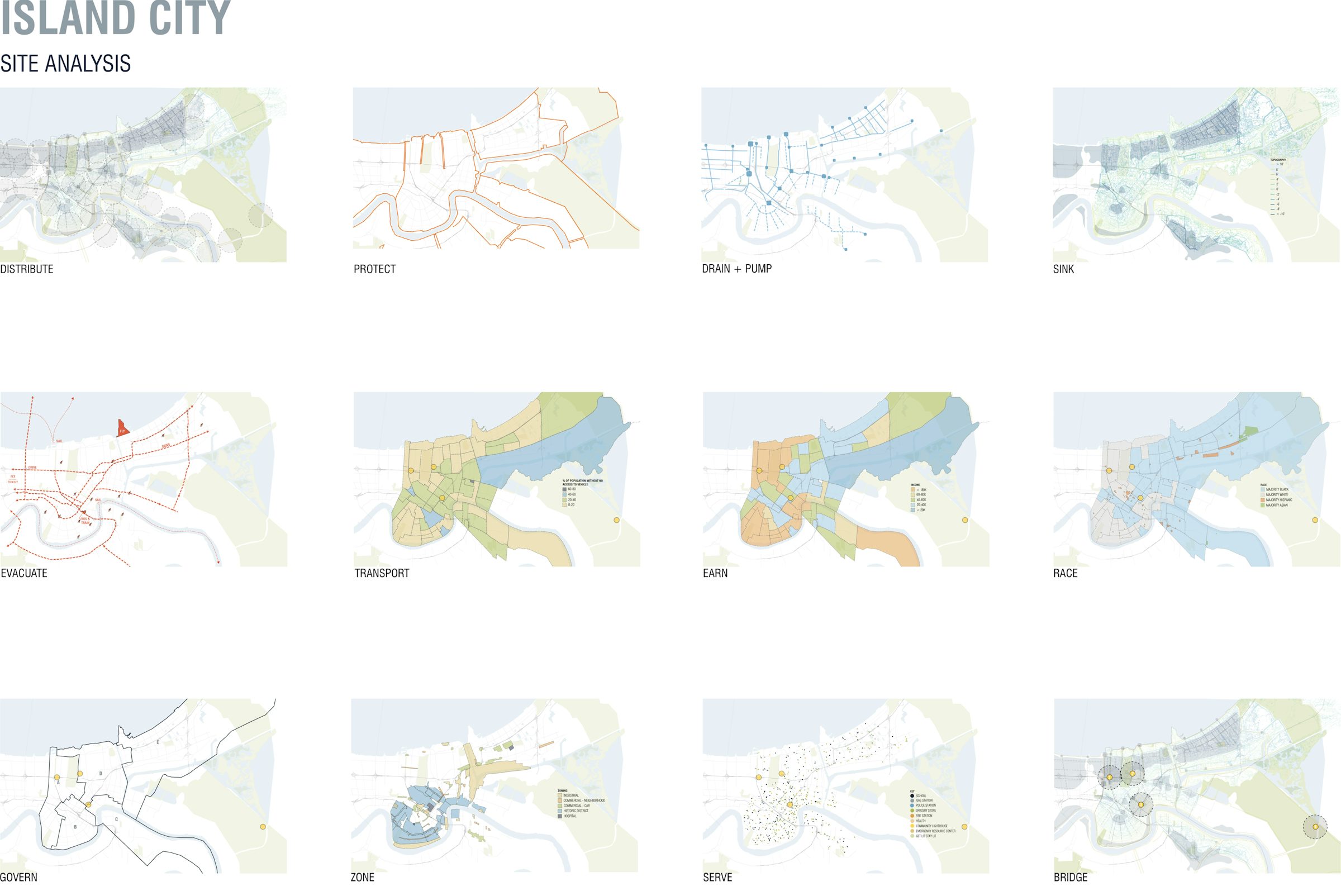
Site Analysis of the Island City
We began by way of a layered analysis process – our team identified factors that affect the landscape and function of spaces within New Orleans, including:
- Walkability (1-mile radii)
- Levee System
- Pumping/Drainage System
- Subsidence
- Evacuation Routes
- Population with Access to a Vehicle
- Income
- Race
- City Council Districts
- Zoning
- Current Networks of Aid
Based on these mappings, we selected three highly varied site conditions to exemplify different locations that could provide a “bridging” between communities before, during and after emergency events. While each concept is site specific, the intention is that the design strategy would be easily modified to effectively apply to similar sites throughout the city.
SITE 1: WEST END RAMPS
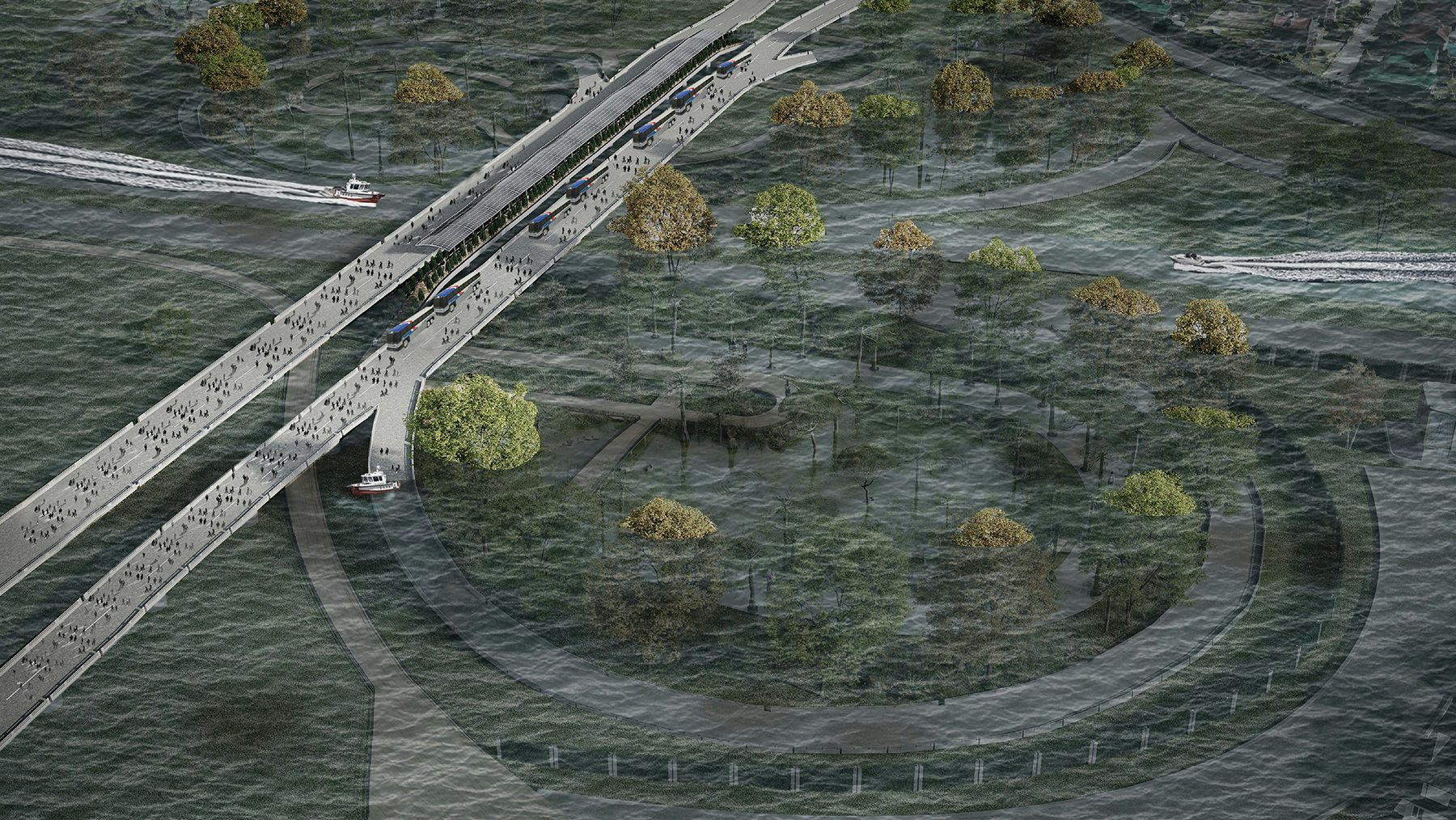
The first proposed site maximizes the use of a standard cloverleaf at one of the largest interstate transportation corridors in New Orleans. Large portions of the city are currently dedicated to interstates that divide neighborhoods and leave large areas of underutilized and unoccupiable space.
SITE ANALYSIS RESULTS
Existing Systems: I-10 on + off ramps near West End and 17th Street Drainage Canal
Bridging Disparity: Connecting flood-prone residential neighborhoods of West End, Lakeview, Lakewood, and Navarre.
Activating the Underutilized: Adding benefit to otherwise unused land inside of ramp "cloverleaf" and providing safe public recreational + educational access.
Multi-Use Program Elements:
- During Stability: Recreational green space, natural stormwater mitigation and retention, vehicle + pedestrian access, solar energy, public transportation, natural habitat for wildlife + vegetation, educational opportunities.
- During Vulnerability: Evacuation point, off-grid power.
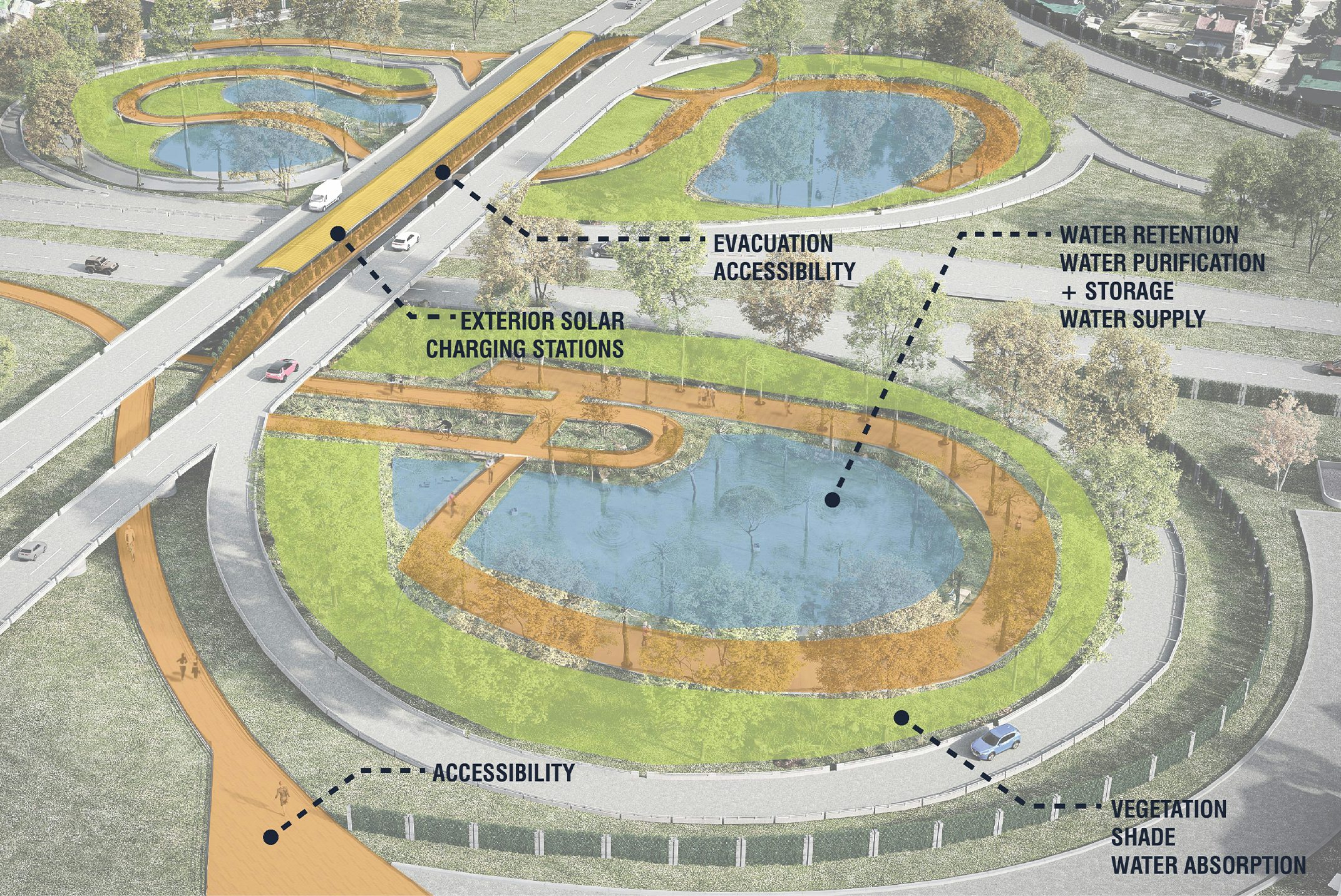
Site 1: West End Ramps
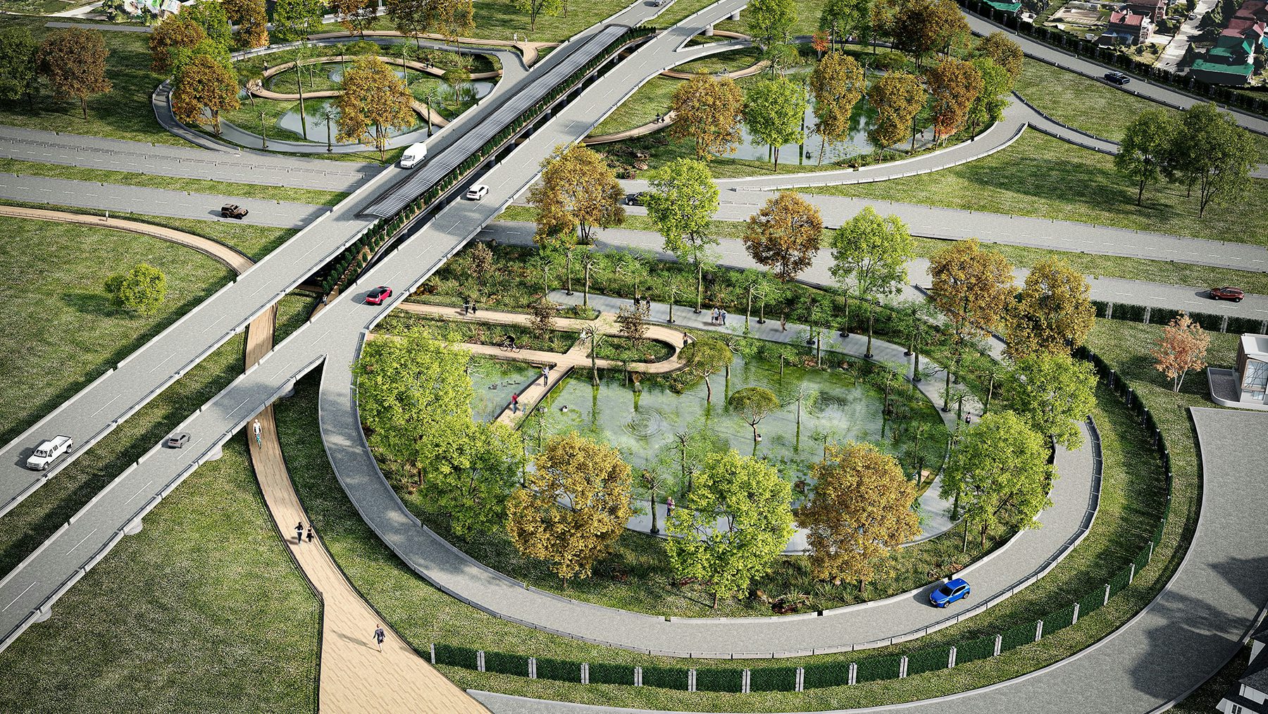
During Stability
During Vulnerability
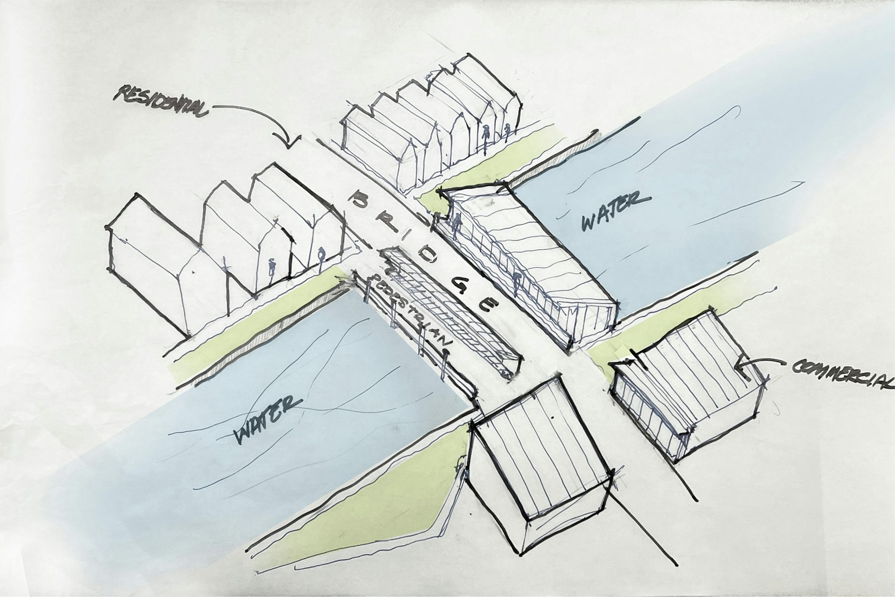
SITE 2: WISNER BRIDGE
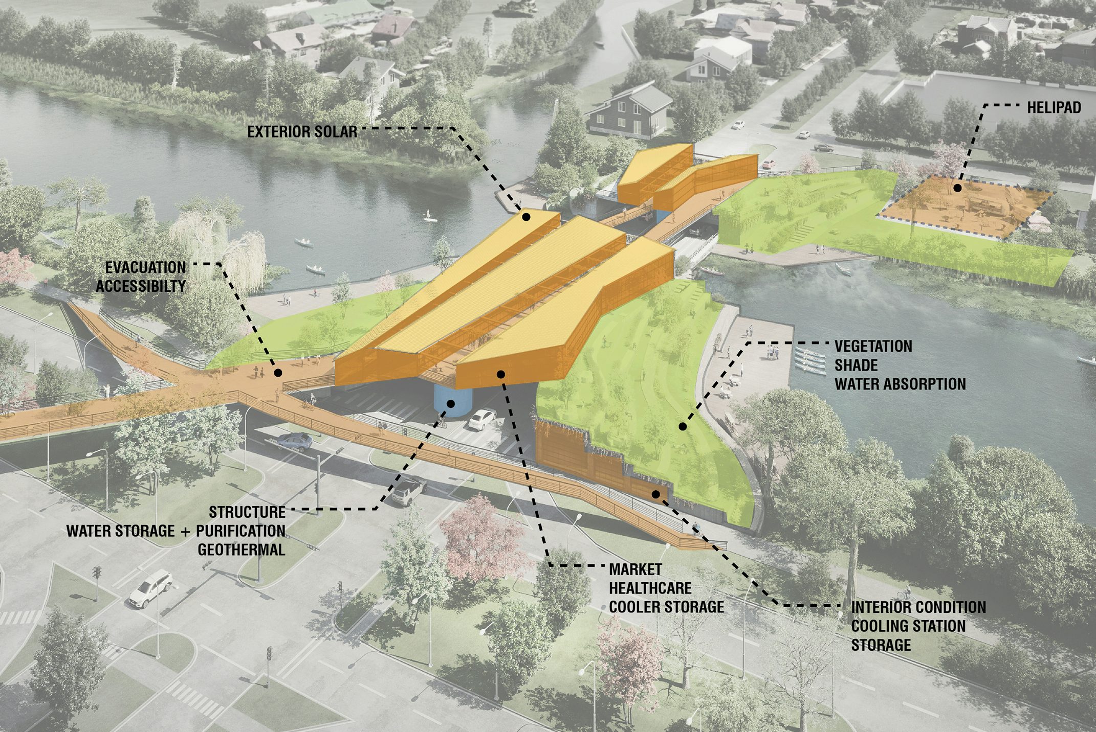
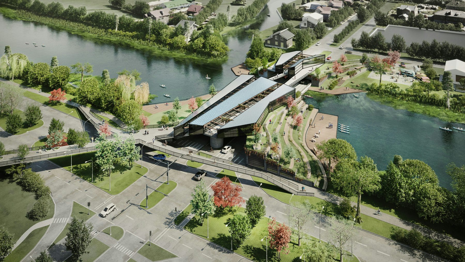
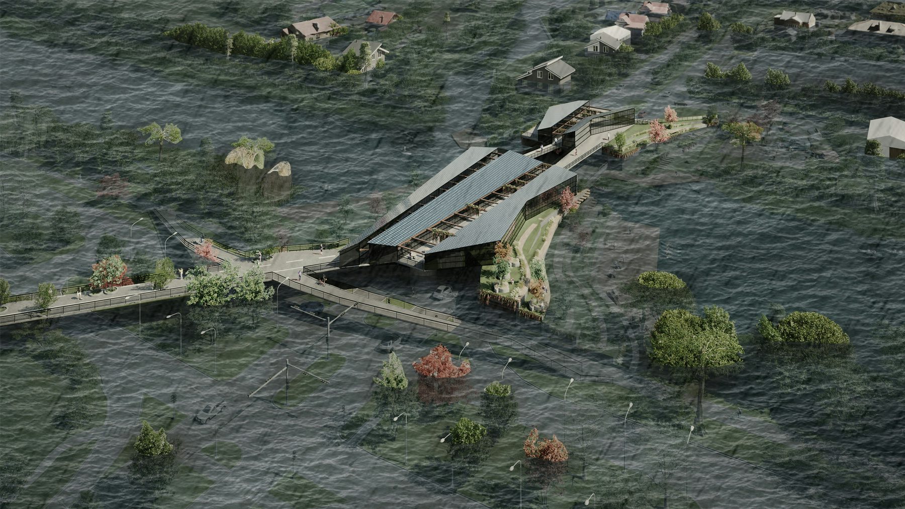
Numerous bridges populate the city to connect neighborhoods across New Orleans’ much-needed canals. These bridges, which are distributed relatively evenly across the city, are currently only serving the sole purpose of transporting vehicles and people across the waterways.
SITE ANALYSIS RESULTS
Existing Systems: Wisner Bridge over Bayou St. John Canal
Bridging Disparity: Connecting residential neighborhoods of City Park, Filmore (low-lying), St. Bernard, and Fairgrounds
Activating the Underutilized: Extending recreational use of City Park and providing opportunity for commerce in an area isolated from living resources.
Multi-Use Program Elements:
- During Stability: Recreational green space, waterway access, stormwater retention, commerce, access to healthcare + community services, entertainment, shade + cooling, vehicle + pedestrian access, solar energy via microgrid.
- During Vulnerability: Evacuation point (vehicle, boat + helicopter), off-grid power, food + water distribution, water purification, shelter, cooling stations, first-aid, emergency government services.
Site 2: Wisner Bridge
During Stability
During Vulnerability
SITE 3: CLAIBORNE OVERPASS + LAFITTE GREENWAY
Large portions of the city are currently dedicated to interstates that divide neighborhoods and leave large areas of underutilized and unoccupiable space.
SITE ANALYSIS RESULTS
Existing Systems: Claiborne Overpass + Lafitte Greenway
Bridging Disparity: Revitalization of historic commercial corridor in low-income area.
Activating the Underutilized: Empty space below the Claiborne Overpass and extension of Lafitte Greenway
Multi-Use Program Elements:
- During Stability: Recreational green space and paths, natural stormwater mitigation and retention, commerce, access to healthcare + community services, entertainment, solar energy.
- During Vulnerability: Evacuation point, off-grid power, food + water distribution, shelter, cooling station, first-aid, emergency government services.
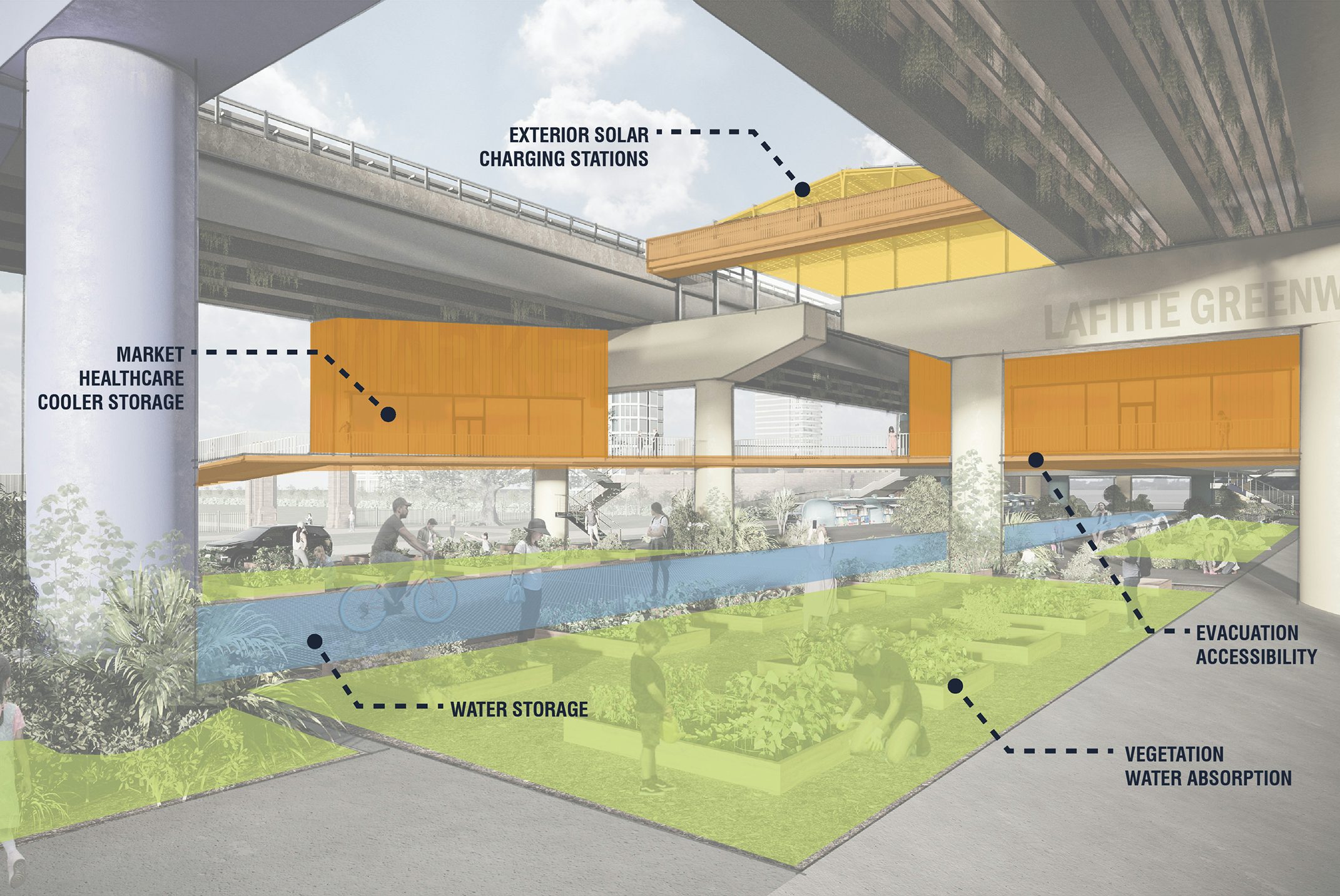
Site 3: Claiborne Pass
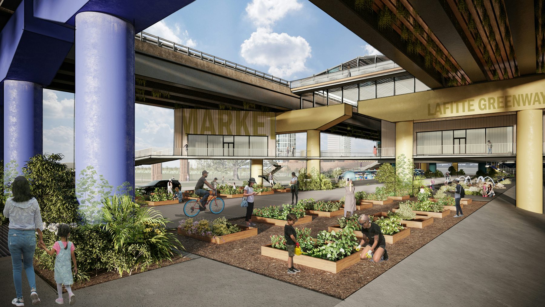
During Stability
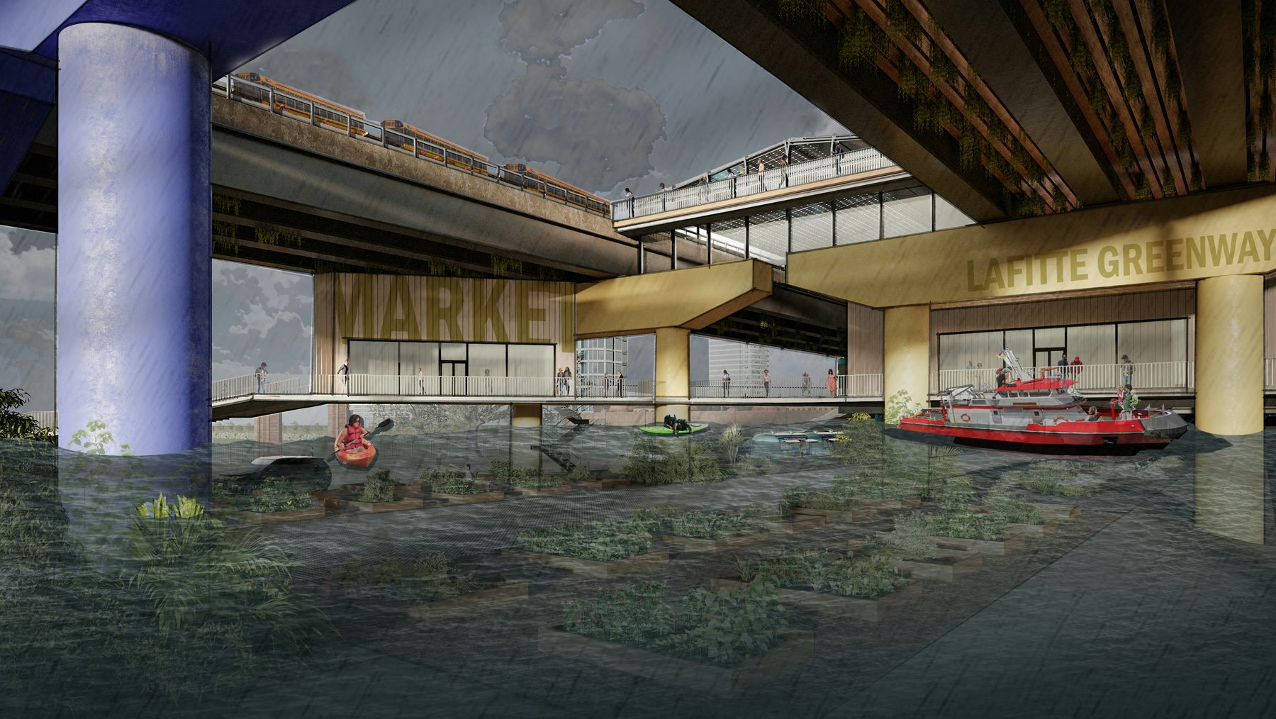
During Vulnerability
SITE 4: BAYOU BIENVENUE CENTRAL WETLAND PARK
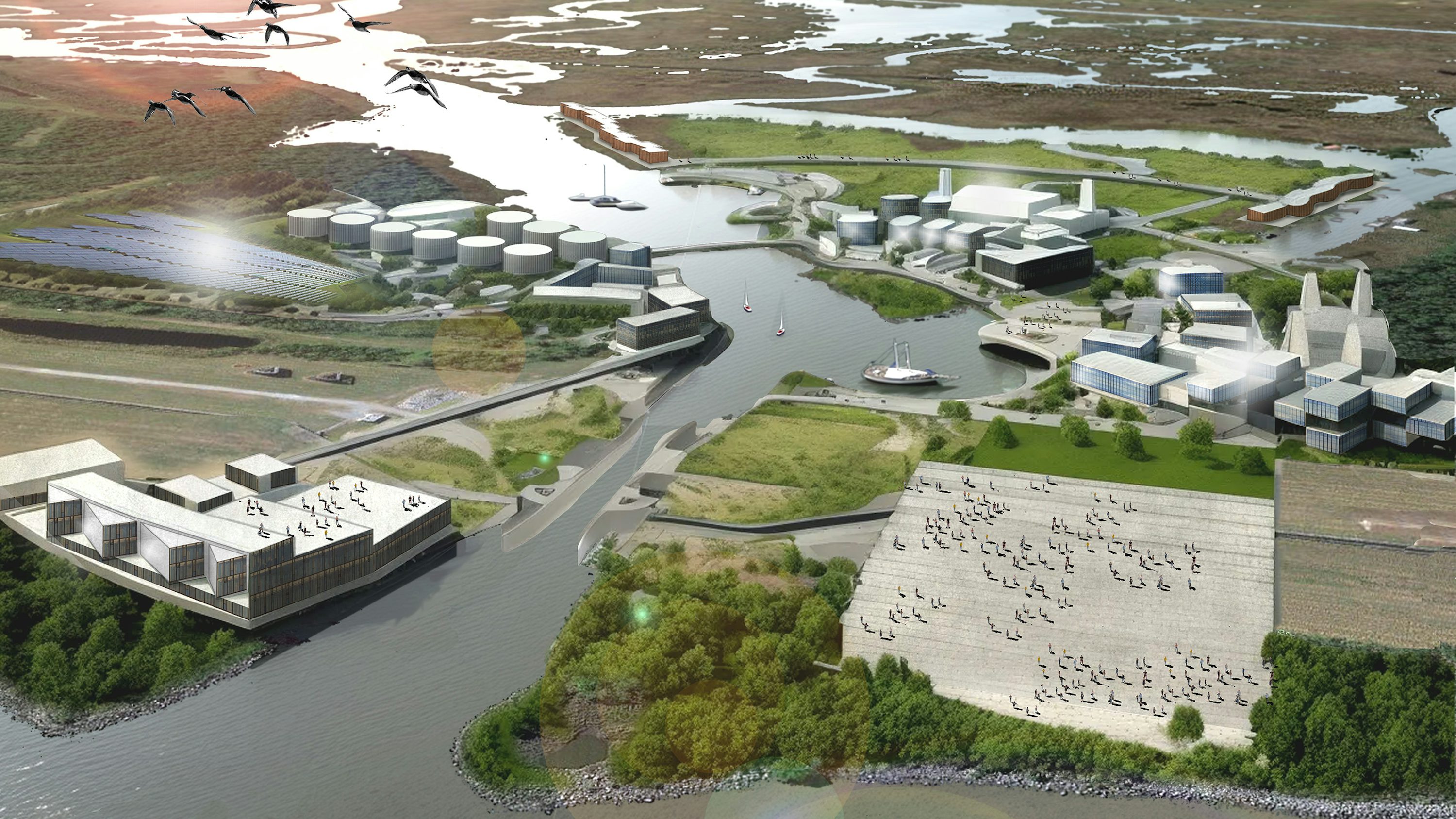
The Safe Harbor Arx at Bayou Bienvenue Central Wetland Park has a twofold purpose: to strengthen the local fishing community and provide protection to vulnerable populations unable to evacuate during disasters. The project team assessed the natural surroundings of the bayou, harnessed existing infrastructure such as the MRGO levee system, and applied an innovative design concept to create a resilient architectural marvel.
This project prioritizes flood protection, while also providing its residents with a sense of community through programmed elements. “Town centers” are at the heart of this community, acting as gathering points for camaraderie, business, and resources while also providing a crucial lifeline for those unable to leave during disasters, establishing the project's status as a beacon of resilience and unity. It also provides a safe harbor for times of stability and times of great instability.
The Safe Harbor Arx project exemplifies a visionary approach to architectural resilience, demonstrating how innovative design and strategic location can enhance the vitality of local communities while safeguarding them against environmental challenges, setting a compelling model for similar endeavors worldwide.
Multi-Use Program Elements:
- During Stability: Fisherman village, education, healthcare, municipal services, farmland, marketplace + retail, recreation, water storage + purification, solar fields
- During Vulnerability: Evacuation point, flood protection, off-grid power, food + water distribution, shelter, cooling station, first-aid, emergency government services
Recent Features + Awards:
- 2023 Thriving Communities Technical Assistance Centers Program: San Juan Symposium, Presenters, U.S. Environmental Protection Agency
- 2023 FORWARD Symposium, Presenters, USGBC Louisiana
- 2023 Shaping the City, Keynote Presenters, New Orleans Symposium
- 2022 A Guide to Thrive, Presenter, Preservation Resource Center
- 2022 Exist, Survive, Thrive, Presenters, STIM Lecture Series, Ennead Architects
- 2022 Award of Merit for Unbuilt Architecture, AIA Louisiana
- 2022 Honor Award for Unbuilt Architecture, AIA New Orleans
- Storm Resilience Projects Gain Steam in New Orleans, New Orleans CityBusiness
- How can New Orleans public spaces become storm-ready hubs?, Times Picayune
- 2021 Shaping the City, Keynote Presenters, Chicago Architecture Biennial
- 2021 Shaping the City, Keynote Presenters, Venice Architecture Biennial
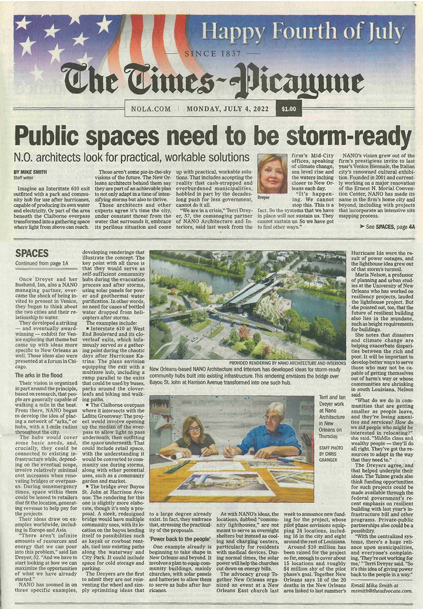
Public Spaces Need to be Storm-Ready, The Times-Picayune (Front Page Article)
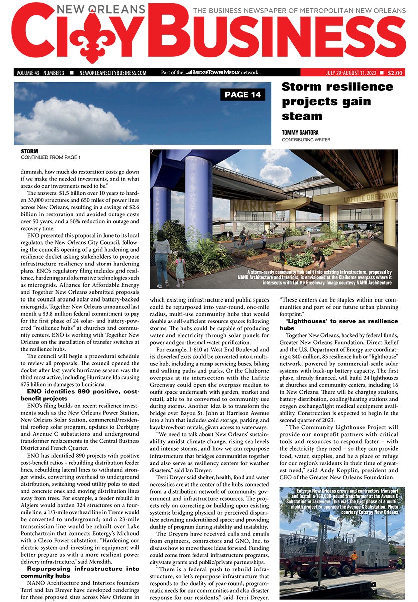
Storm Resilience Projects Gain Steam in New Orleans, New Orleans CityBusiness
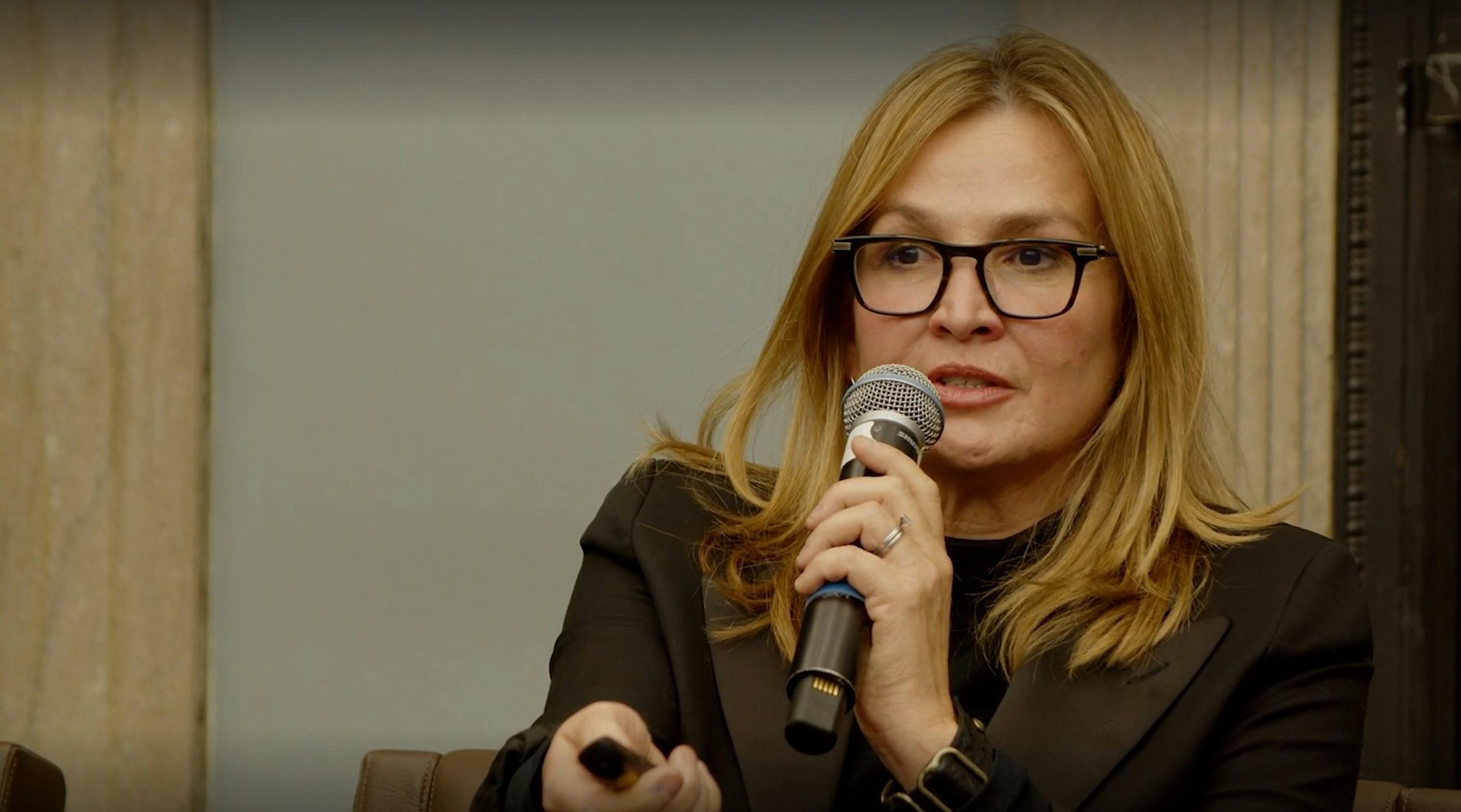
We are within the liminal of global transformation. Within the current crisis of climate change, we are being forced to reflect and ask ourselves, "Are the geographies, economies, infrastructures, and societies of yesterday and today adaptable for the environments of tomorrow?"
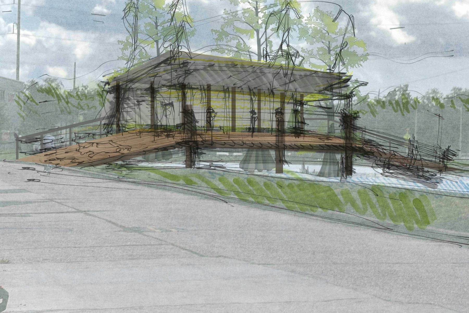
Preliminary Sketch 1
Preliminary Sketch 2